Territorial risk intelligence

One engine. Three jurisdictions. Whatever standard your investors read.

The Azura Engine™ reads a tenement in Brazil, Guyana or Suriname across 13 territorial risk layers and tells you what NI 43-101, JORC, S-K 1300, PERC, GGMC or GMD will expect disclosed — and what to do about it — before a Qualified Person has to find out the hard way.
Submit your AOI ↓
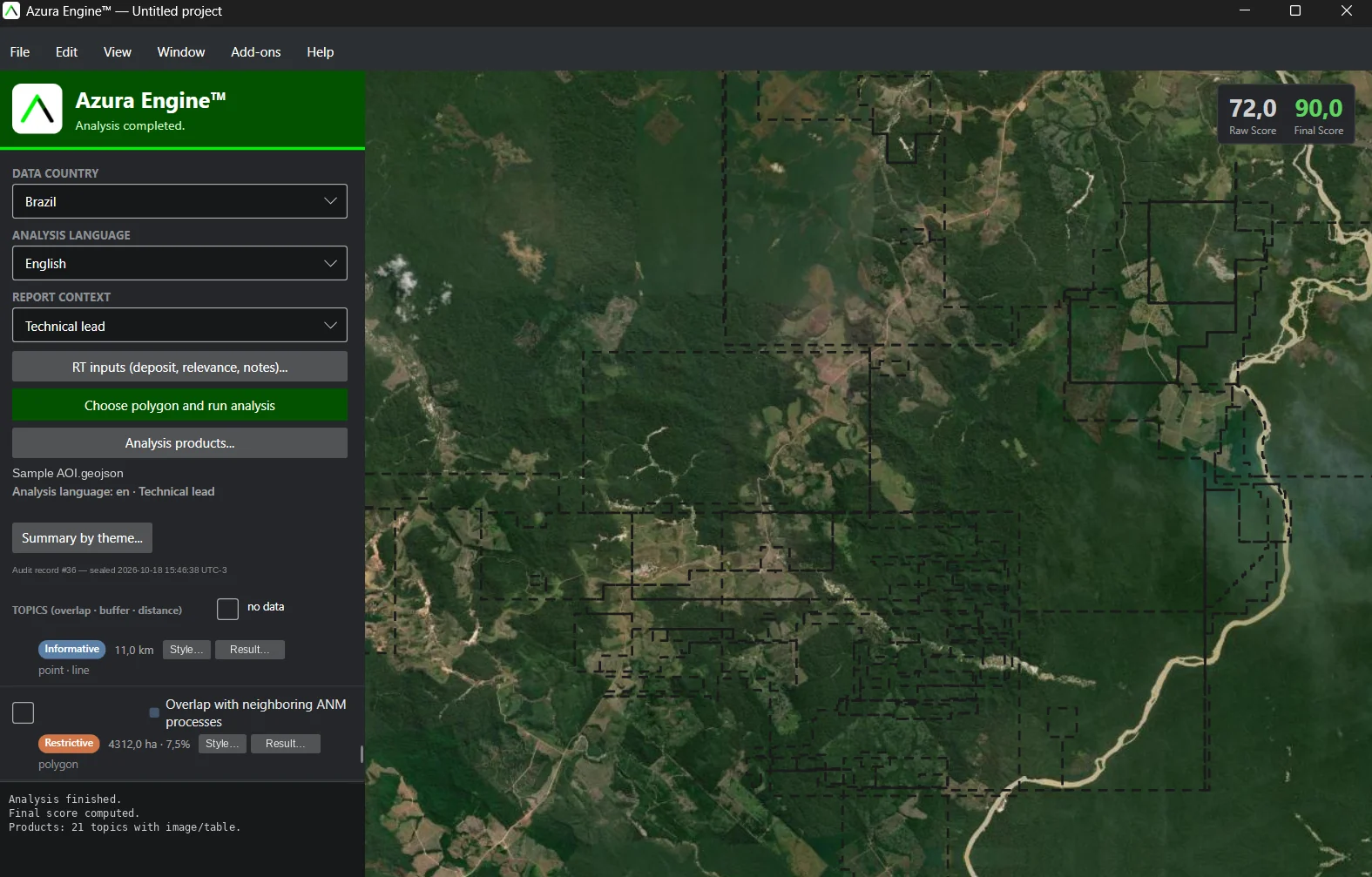
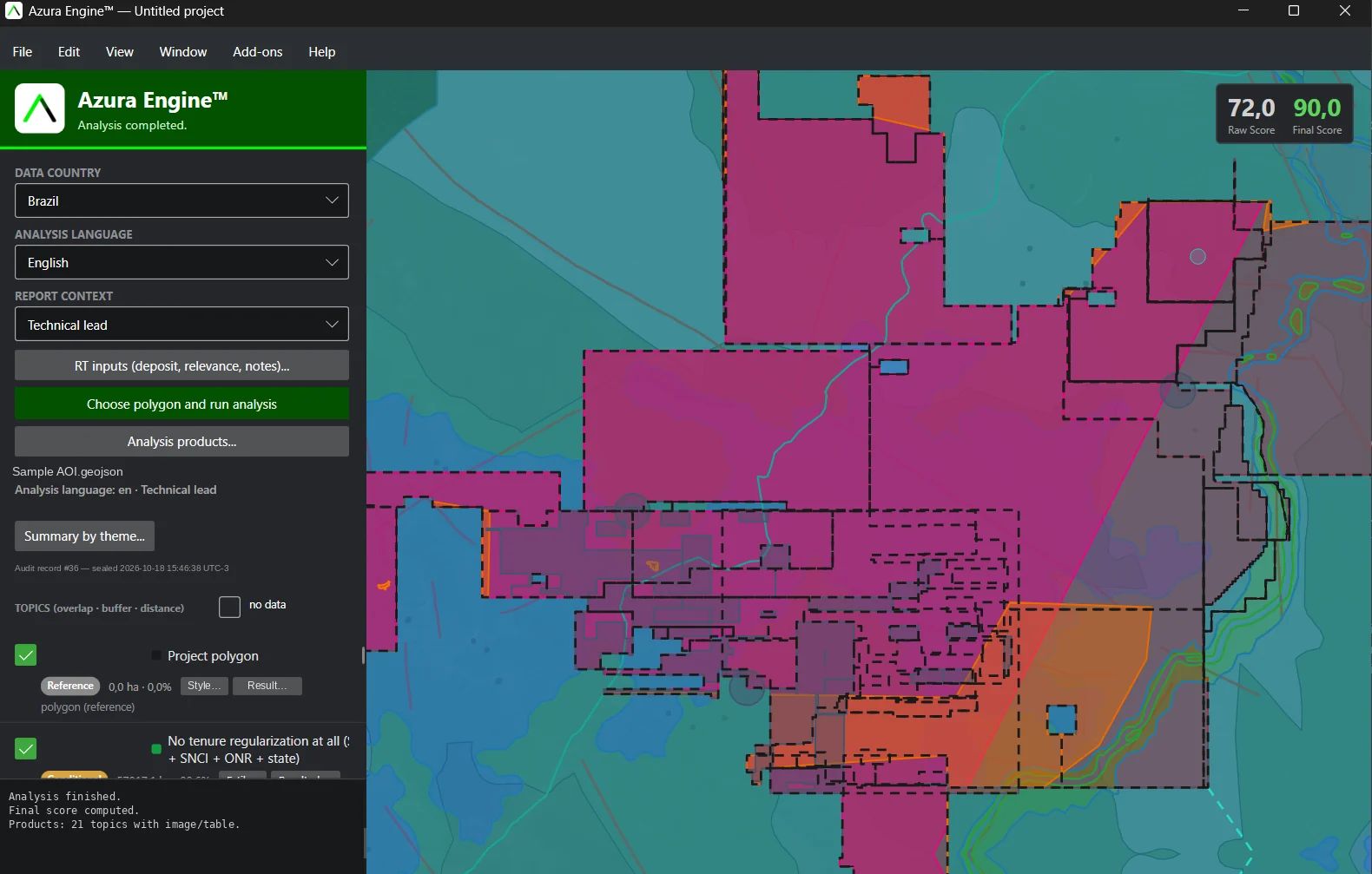
Azura Engine™ analysis with territorial layers drawn over the area of interest
Azura Engine™ — analysis completed, layers drawn on the area of interest
13Territorial risk layers
6Report models
3Jurisdictions
OfflineNo AI, no black box
Inside the engine

From polygon to deliverable, in four moves.

Real screens from the Azura Engine™ desktop application. File names and client details have been removed.

Swipe left to see all 4 steps

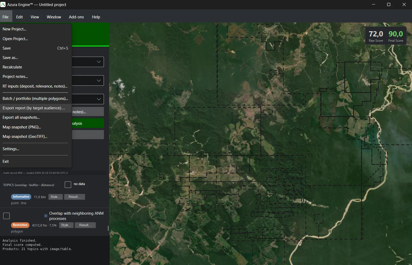
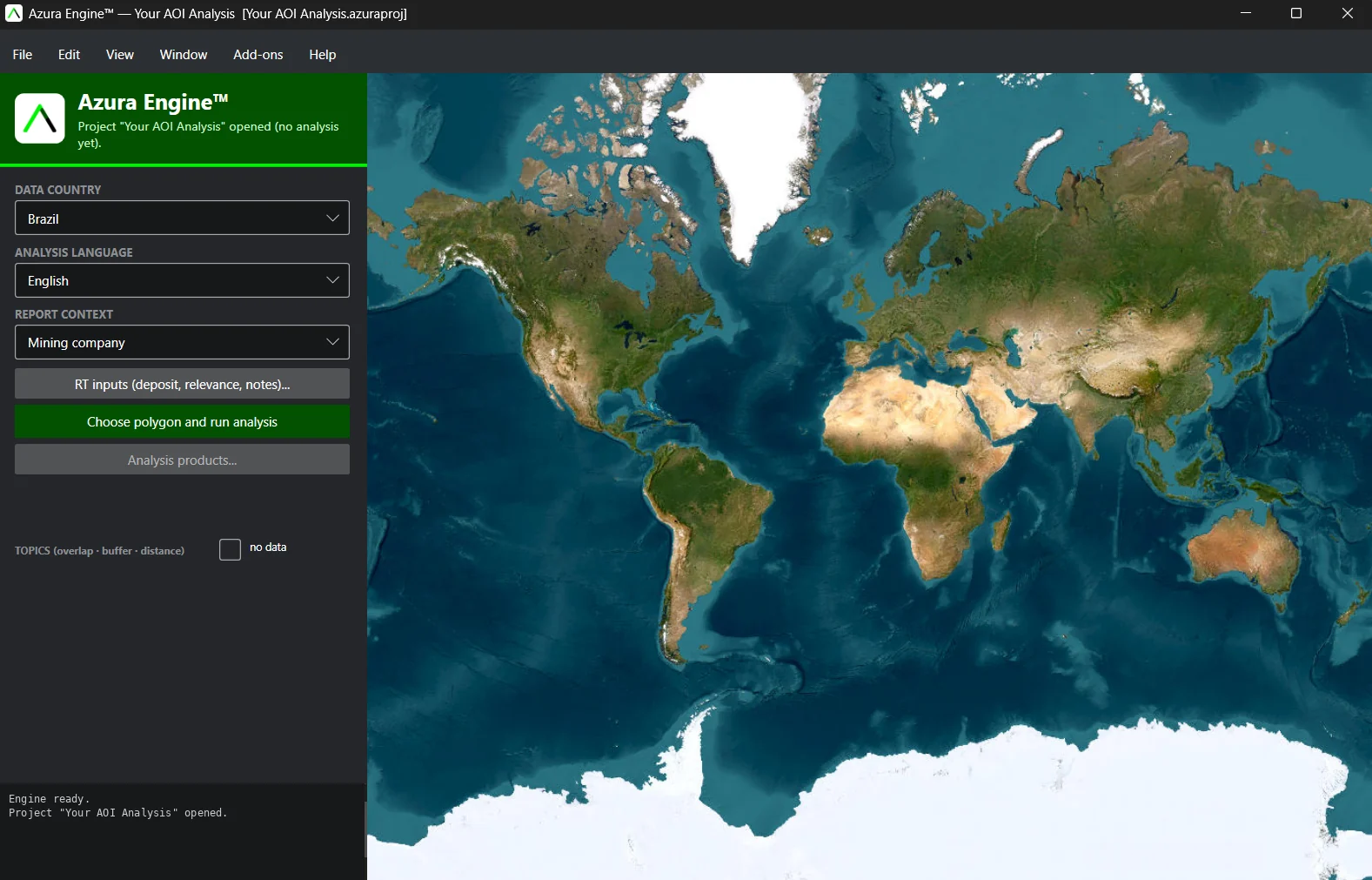
Set the context

Choose the data country — Brazil, Guyana or Suriname — the analysis language and the report context. The same reading is written differently for a mining company, an investor or a technical lead.

  • Country-specific registries and law, loaded per jurisdiction
  • Deposit, relevance and notes recorded with the project
Azura Engine™ project setup: data country, analysis language and report context

Basemap imagery © Esri, Maxar, Earthstar Geographics and the GIS User Community

What we read

13 territorial risk layers

Each layer lands in one of six states. Tap a state to see what it means for your exposure.

InformativeNo risk on its own
Background context only — it won't block a deal, delay a raise, or trigger a disclosure flag. Investors and QPs read this as a clean data point, not a risk to price in.
ConditionalFixable, but on the clock
Moderate risk — solvable with mitigation steps before the next phase. Left unresolved into a raise or filing, it invites extra QP/CP scrutiny and can slow down financing timelines.
RestrictivePriced-in risk
Material risk — the kind investors are trained to discount for. Expect a smaller addressable tenement, added cost, or a valuation haircut until it's resolved.
ImpeditiveDeal-breaking risk
A veto. A single Impeditive layer can sink the entire Territorial Readiness Score regardless of how strong the other 12 layers are — this is the constraint that kills financing rounds and QP sign-off alike.
Not CoincidentNot applicable here
Excluded from the score — this layer simply doesn't apply to this tenement. One exception: on Land Tenure, an unmatched registry escalates straight to Impeditive, because a title with no traceable match is exactly the kind of red flag investors won't ignore.
Not DisclosedThe riskiest label of all
Not because the answer is bad — because there isn't one yet. Investors and QPs treat undisclosed data as critical by default; it's exactly the kind of gap that stalls a raise or a technical report sign-off.
Swipe left to see all 13 layers
01

Land Tenure Regularity

Who actually holds title beneath the asset — and whether that title can turn into litigation later.

InformativeRestrictiveImpeditiveNot CoincidentNot Disclosed
02

Environmental Compliance

Whether permitting and protected-area buffers are already in order — or will cost time and money before operating.

ConditionalRestrictiveImpeditiveNot Disclosed
03

Geological Coherence

Whether the target has real geological consistency — or rests on fragmented data that won't support the investment thesis.

InformativeNot Disclosed
04

Structural Control

Presence of the structural features that actually favour mineral concentration on the tenement.

InformativeConditionalNot Disclosed
05

Geotechnical Risk

Whether the terrain is safe to operate on — slope and landslide risk that raise construction cost and can halt operations.

InformativeConditionalRestrictiveImpeditiveNot Disclosed
06

Geophysical Signature

How much indirect evidence already exists to support the target, reducing uncertainty before a field campaign.

InformativeNot Disclosed
07

Remote Sensing

Satellite-visible indicators that strengthen — or weaken — mineralisation probability before spending on ground work.

InformativeNot Disclosed
08

Hydrographic Network

Whether the water access needed to operate is secured — or will depend on a slow-moving permit.

InformativeConditionalRestrictiveImpeditiveNot Disclosed
09

Social Impact

Traditional and Indigenous communities in the vicinity — the reputational and relationship risk that can stall a social licence to operate.

InformativeConditionalRestrictiveImpeditiveNot CoincidentNot Disclosed
10

Access & Infrastructure

How much it will cost to move ore out — proximity to roads, power and existing logistics.

InformativeRestrictiveNot Disclosed
11

Protected Heritage

Protected sites and assets nearby that could trigger an embargo or require an additional study before proceeding.

InformativeConditionalRestrictiveImpeditiveNot CoincidentNot Disclosed
12

Territorial Restriction

Indigenous territory, restrictive protected areas or military exclusion — the kind of risk that, alone, can sink the project.

ConditionalRestrictiveImpeditiveNot CoincidentNot Disclosed
13

Process Synergy

Whether overlap or dispute with neighbouring tenements could generate litigation or legal uncertainty over the area.

ConditionalRestrictiveNot Disclosed

See all 13 layers read on your own polygon.

Submit your AOI ↓

Need the full scoring story? Request a reading.

Not sure what a state means for your deal?

From finding to fix →
The result

Territorial Readiness Score

Thirteen risk layers become a single number, 0 to 100 — enough to justify an investment, pause a project, or negotiate an acquisition on better terms.

80–100High — proceed to next phase
No Impeditive layers, and at most one or two Conditional items already within normal tolerance.
50–79Moderate — viable, resolve first
Typically 2–4 Restrictive layers flagged — addressable before the next disclosure milestone, not a reason to walk away.
25–49Low — needs a mitigation plan
Usually several Restrictive layers stacking at once, or a single Conditional item left unresolved for too long.
0–24Critical — veto risk
At least one Impeditive layer is present — by design, that alone caps the whole score regardless of how strong the other 12 layers read.

The score isn't an average. An Impeditive risk sinks the result on its own — the same way a legal due diligence doesn't "offset" a serious problem with several positive points. And whatever doesn't apply to the area is excluded from the count, so absence of risk is never confused with absence of information.

The report documents the weight of each risk layer in the final result — so when a QP, Competent Person or investor asks "why this number," the answer is already written, documented and defensible.

See these bands in practice, region by region ↓
See the DVT / TFD Deliverable →
In the field

Azura™ Average by Region

Aggregated Territorial Readiness Score across every tenement Azura™ has read in each region — color-coded to the same bands above, so you can see at a glance where the constraint pressure sits before you order a single diagnostic.

Pará · Brazil
Carajás
Brazil's largest iron ore province — average weighed down by dense overlap with Conservation Units and the Xikrin Indigenous Territory bordering the Carajás National Forest.
54.3
Moderate averagen = 19 tenements read
Pará · Brazil
Tapajós
Widespread artisanal and illegal mining overlap under Process Synergy, compounded by incomplete environmental licensing across much of the district.
38.7
Low averagen = 31 tenements read
Pará · Brazil
Piriá
Bauxite and kaolin licensing backlog under Environmental Compliance keeps this district in the lower band despite reasonable access.
42.1
Low averagen = 9 tenements read
Amapá · Brazil
Serra do Navio
The lowest average in the portfolio — legacy manganese tenure overlaps a conservation mosaic (APA/RESEX) that severely narrows the workable footprint.
23.2
Critical averagen = 7 tenements read
Minas Gerais · Brazil
Southern Minas Gerais
The strongest average in the portfolio — mature registry data, established infrastructure, and low Indigenous or protected-area overlap.
79.8
Moderate averagen = 18 tenements read
Minas Gerais · Brazil
Northern Minas Gerais
Semi-arid terrain keeps Geotechnical Risk manageable, but patchier registry data and weaker Access & Infrastructure hold the average back from the southern district's level.
63.5
Moderate averagen = 13 tenements read
Minas Gerais · Brazil
Jequitinhonha Mineral Province
Strong Geological Coherence from the lithium-bearing pegmatite belt is offset by weak Access & Infrastructure across much of the valley.
52.9
Moderate averagen = 14 tenements read

* Illustrative regional averages. Each individual tenement reading is specific to the asset and can sit well above or below its region's average.

Report models

Six reports. Pick the one your decision needs.

Every report comes from the same reading. AZURA results feed IMAGEO's reporting pipeline, where findings are assembled into a standard report model and reviewed by a Licensed Geologist before delivery. What changes is depth, audience and the decision it is built to support.

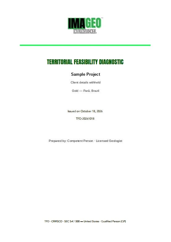
Sample cover of a Territorial Feasibility Diagnostic (TFD)
Sample TFD cover — client details withheld
For junior mining companies
TAP
Territorial Assessment Preview

The 3 most critical layers, read fast — advance, adjust or reconsider before spending more.

TFD
Territorial Feasibility Diagnosis

All 13 layers, the Territorial Readiness Score and a Constraint Roadmap — to move into financing, PFS or licensing.

For investors & financiers
TRS
Territorial Risk Screening

A fast pre-commitment read for PE, family offices and cornerstone investors: invest, pause or dig deeper.

TDDR
Territorial Due Diligence Report

The full, defensible report for M&A — price inputs, reps & warranties and carve-out options.

TCA
Territorial Compatibility Assessment

Side-by-side reading of both partners' ground before a joint venture is signed.

ETCR
EP4 Territorial Compliance Report

EP4-aligned dossier with the FPIC trail, for Equator Principles banks and DFIs.

See what each investor report covers →
Not sure which report fits?

Send the polygon. We'll tell you.

Submit your AOI ↓
Emerging issues

Same asset, different disclosure risk — depending who's reading it

A Canadian QP, an Australian Competent Person and a US SEC filer looking at the same Guyana tenement will each flag different things as material. The Azura Engine™ is built around that friction, not around one generic checklist.

Brazil flag

Brazil

ANM / SIGMINE
Post-2026 STF ruling on indigenous land recognition ("marco temporal") has reshaped how buffer distance to Terra Indígena boundaries gets treated as material — a tenement that looked clear 18 months ago may not read clear today.
View reporting standards +
NI 43-101 — QP sign-off carries personal liability; independent verification of ANM process status plus explicit TI/quilombola proximity disclosure is expected, not optional.
JORC — Materiality tested against "reasonable investor" expectation; often demands field verification rather than a desk-only ANM check.
S-K 1300 — Requires probability-weighted valuation impact for permitting risk; Ibama/state licensing timelines routinely cited as a subsequent risk factor.
PERC — AIM-listed juniors with Brazilian assets face the same Legal/Title Modifying Factor test — TI/quilombola proximity must be stated explicitly, not left implicit in the ANM filing.
ANM / DNPM (local) — The underlying record every standard above reconciles against — ANM/SIGMINE tenure plus legacy DNPM titles.
Guyana flag

Guyana

GGMC / Amerindian Act 2006
Village titled-land boundaries under the Amerindian Act frequently disagree with GGMC's own cadastral polygons — by hundreds of metres in places — leaving a due-diligence blind spot most desk reviews never catch.
View reporting standards +
NI 43-101 — Most TSXV-listed exploration permits sit on GGMC licences; the QP must independently reconcile GGMC tenure with Ministry of Amerindian Affairs titled-land data before disclosing "clear title."
JORC — The Competent Person applies the same "reasonable investor" materiality test to GGMC tenure — Amerindian titled-land overlap is assessed for materiality, not just noted in passing.
S-K 1300 — SEC filers must quantify permitting risk with a probability-weighted value; GGMC renewal timelines and EPA permit status are treated as direct valuation inputs.
PERC — London/AIM-listed juniors have faced scrutiny for under-disclosing Indigenous land overlap; the Competent Person is expected to state any encumbrance explicitly.
GGMC (local) — Local licence validity alone is not equivalent to social licence to operate — a distinction international standards increasingly force to the surface.
Suriname flag

Suriname

GMD / Mijnbouwdecreet
Maroon community land rights are recognised in practice (IACHR rulings) but not fully codified in Surinamese statute — a gap between "legal" tenure and "social licence" that doesn't show up in a GMD paperwork check alone.
View reporting standards +
NI 43-101 — Cross-border issuers with Suriname assets must reconcile GMD paperwork against unmapped customary boundaries — a data gap the Azura Engine flags rather than silently omits.
JORC — Materiality is tested against what GMD paperwork actually confirms versus unmapped Maroon customary boundaries — the gap itself is the disclosure item.
S-K 1300 — Unresolved customary tenure must be quantified as a probability-weighted risk to valuation, not left as a qualitative footnote.
PERC — Investors increasingly expect disclosure of community agreements even where domestic law doesn't strictly require it; silence reads as a governance flag, not a clean file.
GMD (local) — The underlying record: GMD concession status (Reconnaissance / Exploration / Exploitation) under the Mijnbouwdecreet E-58 — the base every international standard above reconciles against.
Regulatory Filing Requirements

One project, five filing regimes.

NI 43-101, JORC, the AIM Note, S-K 1300 and PERC all trace back to the same CRIRSCO resource/reserve template — where they diverge is in how much territorial and tenure risk has to be documented, and by whom, before a number can be published.

Swipe left to compare all five standards
Standard Exchange(s) Governing Body Reporting Document Sign-off Authority Territorial / Tenure Disclosure
NI 43-101 TSX / TSXV CSA (Canadian Securities Administrators) Technical Report Qualified Person (QP) Land tenure status, surface rights, environmental liabilities, permits in good standing
JORC Code ASX JORC Committee (AusIMM / AIG / MCA) Public Report Competent Person (CP) Legal tenure, native title status, environmental approvals
AIM Note (Mining, O&G) AIM (London Stock Exchange) London Stock Exchange Competent Person's Report (CPR) Competent Person Tenure status, key permits, environmental and social risk summary
S-K 1300 NYSE / NASDAQ U.S. SEC Technical Report Summary (TRS) Qualified Person Surface / mineral rights, permitting status, environmental compliance
PERC Pan-European exchanges PERC Reporting Standards Committee Public Report Competent Person Tenure, permitting and environmental status, aligned to the CRIRSCO template

Every one of these disclosure requirements maps to one or more of the Azura Engine™'s 13 territorial risk layers — so a single reading is already structured for whichever standard your investors read.

Not sure what a Qualified Person or Competent Person is? See the glossary →
↓ Download this methodology as PDF
Azura Workspace

Three add-ons that take Azura into the lab and the field.

Separate modules around the same engine — each one can be adopted on its own.

Multispectral · Hyperspectral · SAR · LiDAR

Azura OreVision™

Add-on for satellite and drone imagery. From multispectral and hyperspectral reflectance it extracts diagnostic band ratios and classifications for mineral exploration, tied to the paragenesis of the mineralising control. From SAR and LiDAR it captures precise local geometric factors. Outputs are high-capacity products, optimised to feed straight into the geological study.

Geophysics · Geochemistry · Drilling · Resource

Azura Grader™

Add-on that processes geophysical data — magnetics, gamma-ray spectrometry (K, eTh, eU), IP/resistivity and gravity — and geochemical data from soil, stream sediment, rock chip and drill core (fire assay, ICP-MS/OES, XRF, pXRF). It integrates with drill-hole planning, orebody modelling and volume and tonnage estimation.

Field guide · Desktop · Rugged PDA

Azura Mapper™

Add-on that works as a field guide on desktop or a rugged PDA: RTK point capture, photos, point plotting and local-scale lithostratigraphic and structural data. It displays raster guides for navigation — hypsometry, slope, hillshade, drainage and contours — and plots an ultra-detailed local geological map with structural solution and structural/lithostratigraphic cross-sections.

Module availability is staged — contact us for the current status of each.

Start here

Send us your Area of Interest.

Give us a polygon, an asset, a mineral project or a jurisdiction — and let the territory speak.

  1. 01We check the jurisdiction and the data available for your AOI.
  2. 02We confirm which report fits your decision, with scope and timing.
  3. 03Your polygon is handled confidentially and used only for this assessment.
DATUM: WGS 84 (Guiana Shield) / SIRGAS 2000 (Brazil)